 Community Center hours are:
Mon-Wed-Fri: 6AM-8:30PM
Tue-Thur: 9AM-8:30PM
Saturday: 8AM-1:00PM
Sunday: Closed
The park hours are still 7AM-11PM 7 days a week.
******July 3, 2014******
WP1, 2, 4 and 5 have been "compromised". The brass plaques have been removed from the concrete and destroyed. So, I have attached new smaller aluminum plates (tags) with the necessary coordinates and letter needed to complete the course and determine the combination.
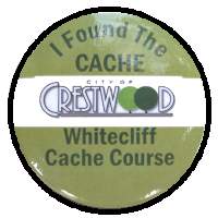
Each of the first 3 waypoints consists of a 6" square brass or aluminum plaque imbedded in concrete and engraved with the coordinates of the next waypoint along with a single letter. The fifth waypoint will contain the coordinates of the actual cache, and the cache will have the last letter. The six letters obtained along the way, in sequence, will provide the numbers needed to open the combination lock on the cache. The lock has become "compromised". To open, continue turning past the final digit while pulling on the door. The knob will be quite stiff, but 3-6 digits past the final coordinate, the door will open and the lock will again turn normally. This is really a "take" cache so the children can get a reward for the hunt. Nothing should be left in the cache box except a log entry. The cache contains special Crestwood Geocache pencils, buttons, sometimes some SWAG, and a logbook. Each cacher should take just one of each and leave a log entry.
Waypoint 1 and 2 comprise the codes for the first number for the combination, WP 3 and 4 for the second number and WP 5 and the cache box for the third. The lock is the normal "3 full turns to the RIGHT stopping at the first number, LEFT one full turn past the first number stopping at the second, and RIGHT to the third number". Continue turning right after the last number until the dial stops and pull open the door. Please close the door securely when finished and turn dial LEFT one full turn.
Enter the letter from each waypoint below and then use the chart to convert the letter to the proper number for the combination.
WP1___WP2___     WP3___WP4___     WP5___ Cache___

|A|B|C|D|E|F|G|H|
---------------------
|4|5|2|1|1|5|0|3|

Combination= ____,  ____,  ____
i.e. If WP 1-5 and the cache contains A, C, G, F, D, & H
 and equates to 4, 2, 0, 5, 1, & 3.
The combination would be 42, 05, 13.
This is a first for the St. Louis area and the state of Missouri whereas a city is behind and encourages the Geocaching craze. The park is open to bushwacking between the waypoints or a leisurely walk along the trails. Please adhere to the park hours of 7AM to 11PM, 7 days a week.
The lower parking area near WP 1 closes at 1/2 hour after dusk, but the road is open until 11PM for walking. Additional parking is available in the upper level of the park.
NOTES:
- All of the waypoints are within the 100-acre park boundaries.
- Between WP 4 and 5 there is a private residence. Please avoid crossing their property.
- After you have found the cache you can continue down the trail, keeping to the right, and return to the parking lot near waypoint 1. Total distance is appoximately 1.75 miles, but your mileage may differ.
Also available at the Community Center are maps and hints for the waypoints and the actual cache. This will provide a way for those without a GPS to participate in the hunt and reward. The Crestwood Parks website also contains links to the maps and hints in Adobe PDF format.
Grant's Trail, a paved 8 mile bike path, is just 1 block from the park entrance. It follows an old RR bed along Gravois creek and goes I-44 & Big Bend East to Interstate 55.
3/4 miles East (Grant Rd & Gravois) is the location of Grant's Farm, an enjoyable place to tour.